 Back
Back[A_Labraza_Nevera] Documentación geométrica de la nevera de Labraza (Oyón-Oion, Álava)
| dc.contributor.author | Rodriguez-Miranda, Alvaro | |
| dc.contributor.author | Valle Melón, José Manuel  | |
| dc.coverage.spatial | Nevera de Labraza (Oyón-Oion) | |
| dc.coverage.spatial | Oyón-Oion, Álava, España/Spain (Getty TGN: 7303110) | |
| dc.coverage.temporal | 2017 | |
| dc.date.accessioned | 2017-09-26T15:44:37Z | |
| dc.date.available | 2017-09-26T15:44:37Z | |
| dc.date.issued | 2017-09 | |
| dc.identifier.citation | Laboratorio de Documentación Geométrica del Patrimonio (Universidad del País Vasco-Euskal Herriko Unibertsitatea UPV/EHU) –LDGP-. Documentación geométrica de la nevera de Labraza (Oyón-Oion, Álava). 2017 | es_ES |
| dc.identifier.uri | http://hdl.handle.net/10810/22697 | |
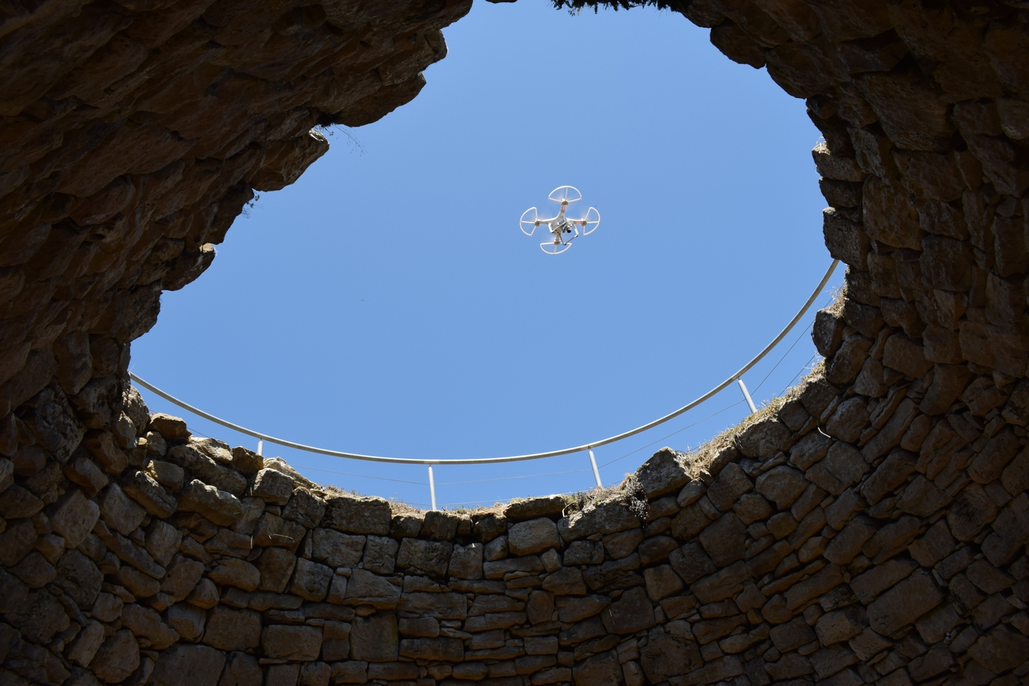
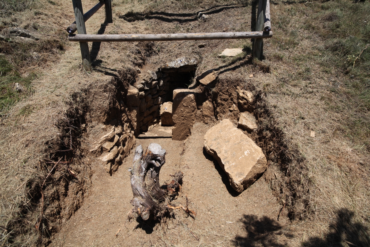
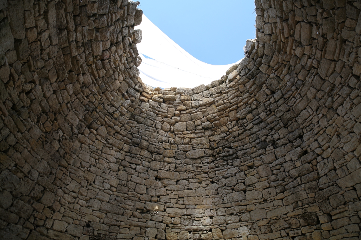
| dc.description.abstract | [ES] Se trata de un pozo construido en mampostería de unos 7,4 metros de diámetro y 9 de altura, con forma de cilindro rematado en una falsa cúpula apuntada. Dispone de un acceso a media altura mediante una galería en zigzag. Su construcción requirió de un montículo artificial de más de 10 metros de radio. La red de referencia se observó con GNSS, se dispuso de un apoyo sobre las paredes mediante dianas de puntería cuyas coordenadas se obtuvieron con estación total. La documentación fotográfica se hizo con una cámara réflex, imágenes desde dron y tomas con una cámara panorámica. La información se ha procesado en software fotogramétrico para generar un modelo de superficies con textura fotográfica a partir del cual se han obtenido ortoimágenes y una colección de planos. | es_ES |
| dc.description.abstract | [EN] A well of 7.4 meter of diameter and around 9 meters high with the shape of a cylinder with a corbeled dome on top. Apart from the load hole (above) there is a narrow zigzag access. The construction required an artificial mound of more than 10 meters radius. The documentation started with the placement of the reference network by means of GNSS techniques, the control points (targets) were measured with a total station and the photographs were taken with three different cameras: a reflex, one mounted on a drone and a panoramic one. Information were processed with photogrammetric software in order to generate a three-dimensional surface model with photographic textures. From this 3D model products such as plans or orthoimages were generated. | es_ES |
| dc.description.tableofcontents | [ES] Memoria del proyecto (70 páginas) y 6 fotografías de documentación. | es_ES |
| dc.description.tableofcontents | [EN] Report of the project (70 pages) and 6 photographs for documentation purposes. | en |
| dc.language.iso | spa | es_ES |
| dc.relation.ispartofseries | LDGP_mem_042-1 | |
| dc.rights | info:eu-repo/semantics/openAccess | es_ES |
| dc.rights.uri | http://creativecommons.org/licenses/by-nc/3.0/es/ | * |
| dc.subject | patrimonio cultural | es_ES |
| dc.subject | etnología | es_ES |
| dc.subject | reconocimiento topográfico | es_ES |
| dc.subject | fotogrametría | es_ES |
| dc.subject | cultural heritage | es_ES |
| dc.subject | ethnology | es_ES |
| dc.subject | surveying | es_ES |
| dc.subject | photogrammetry | es_ES |
| dc.title | [A_Labraza_Nevera] Documentación geométrica de la nevera de Labraza (Oyón-Oion, Álava) | es_ES |
| dc.title.alternative | Geometric documentation of the mountain ice house of Labraza (Oyón-Oion, Álava, Spain) | es_ES |
| dc.type | info:eu-repo/semantics/report | es_ES |
| dc.rights.holder | Atribución-NoComercial 3.0 España | * |
| dc.coverage.spatiallink | http://maps.google.com/maps?q=42.6037,-2.4194 | |
| dc.coverage.spatiallink | http://vocab.getty.edu/tgn/7303110 |
Files in this item


This item appears in the following Collection(s)

Except where otherwise noted, this item's license is described as Atribución-NoComercial 3.0 España