 Back
Back[A_Llodio_Yermo] Documentación geométrica para la puesta en valor y difusión social del Santuario de Santa María del Yermo (Laudio/Llodio, Álava)
| dc.contributor.author | Pérez Vidiella, Pablo | |
| dc.contributor.author | Rodriguez-Miranda, Alvaro | |
| dc.contributor.author | Valle Melón, José Manuel  | |
| dc.coverage.spatial | Santuario del Yermo (Laudio/Llodio) | |
| dc.coverage.spatial | Laudio/Llodio, Álava, España/Spain (Getty TGN: 7307306) | |
| dc.date.accessioned | 2016-03-01T11:30:31Z | |
| dc.date.available | 2016-03-01T11:30:31Z | |
| dc.date.issued | 2015-09 | |
| dc.identifier.uri | http://hdl.handle.net/10810/17466 | |
| dc.description | [ES] Este trabajo tuvo una continuación los dos años siguientes, los informes también puede consultarse en este repositorio: ● LDGP_mem_040-2: "[A_Llodio_Yermo] Documentación geométrica para la puesta en valor y difusión social del Santuario de Santa María del Yermo (Laudio/Llodio, Álava). Campaña 2016.", http://hdl.handle.net/10810/24487 ● LDGP_mem_040-3: "[A_Llodio_Yermo] Documentación geométrica para la puesta en valor y difusión social del Santuario de Santa María del Yermo (Laudio/Llodio, Álava). Campaña 2017.", http://hdl.handle.net/10810/32114 | es_ES |
| dc.description | [EN] This works continued the following year. The report is also available in this repository: ● LDGP_mem_040-2: " Geometric documentation for valuing and extending the social use of “El Yermo” Sanctuary (Llaudio/Llodio, Álava, Spain). Year 2016", http://hdl.handle.net/10810/24487 ● LDGP_mem_040-3: "Geometric documentation for valuing and extending the social use of “El Yermo” Sanctuary (Llaudio/Llodio, Álava, Spain). Year 2017", http://hdl.handle.net/10810/32114 | en |
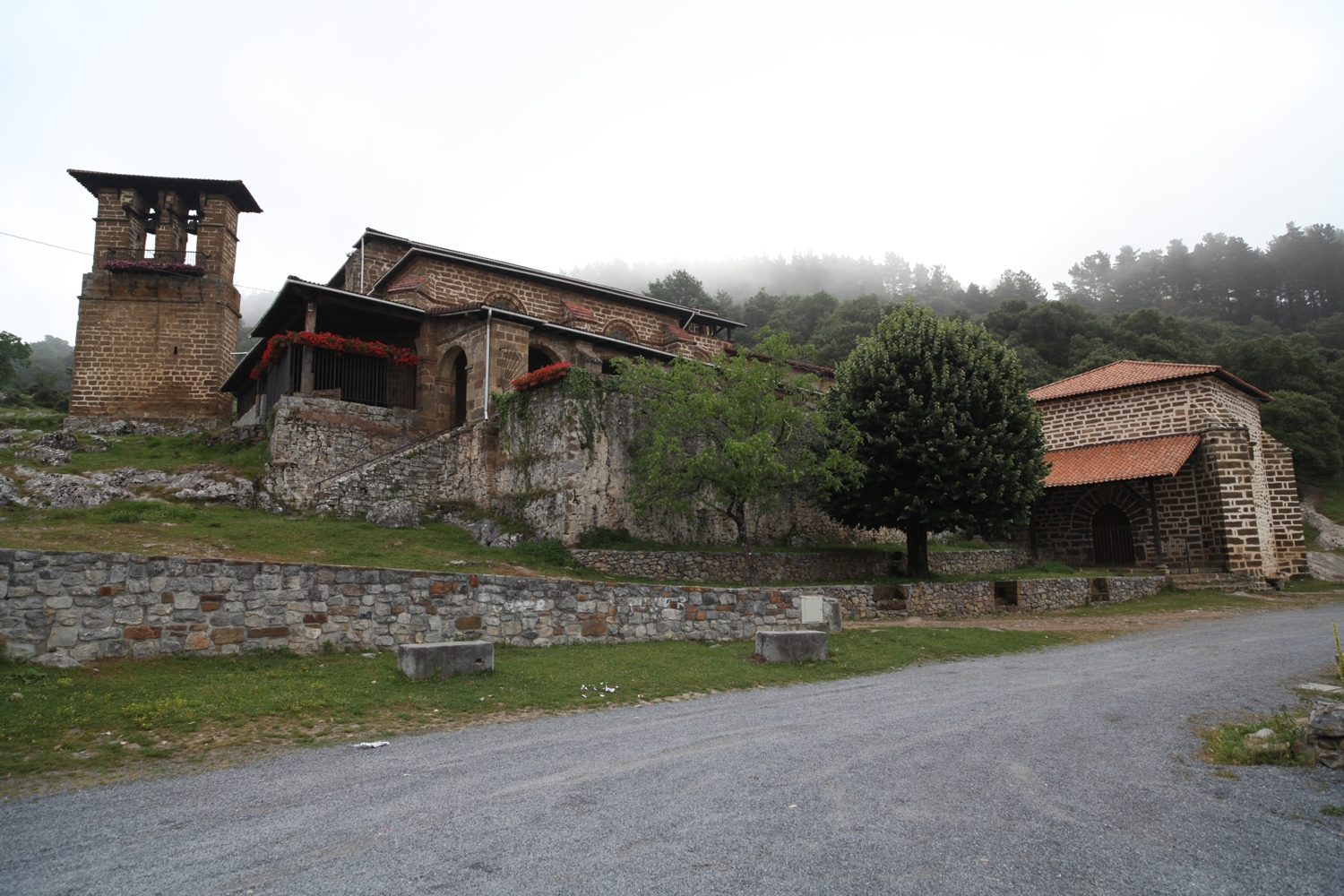
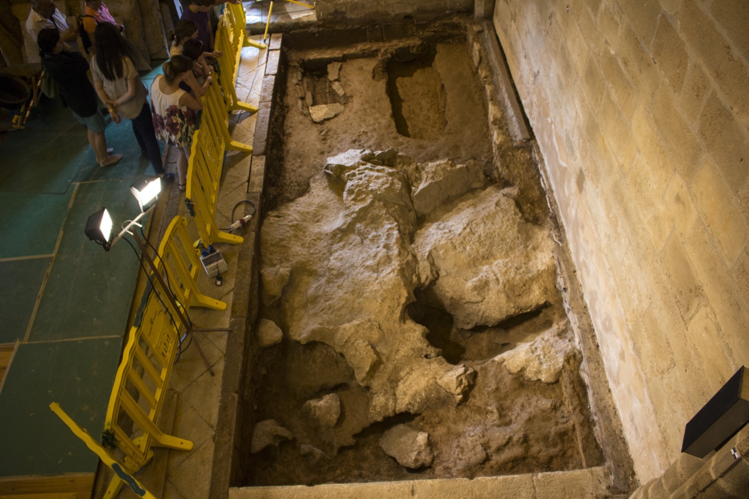
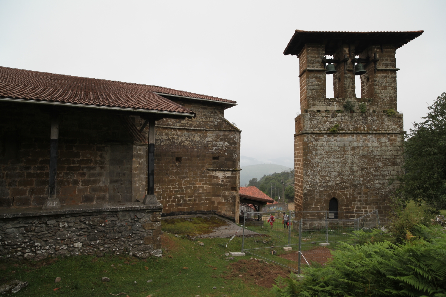
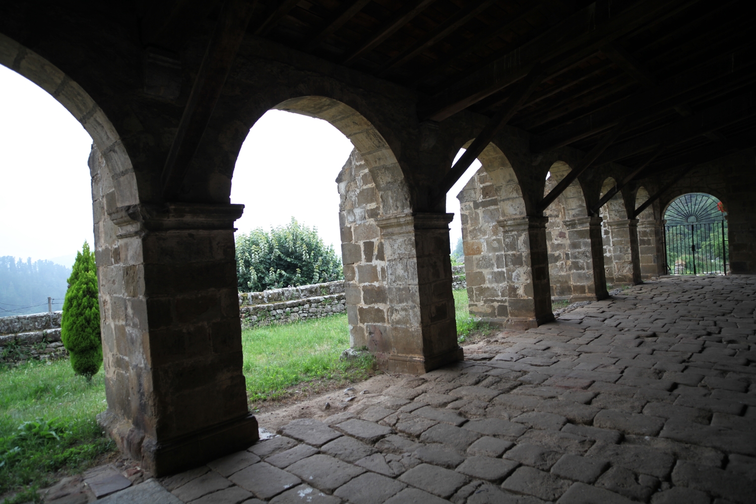
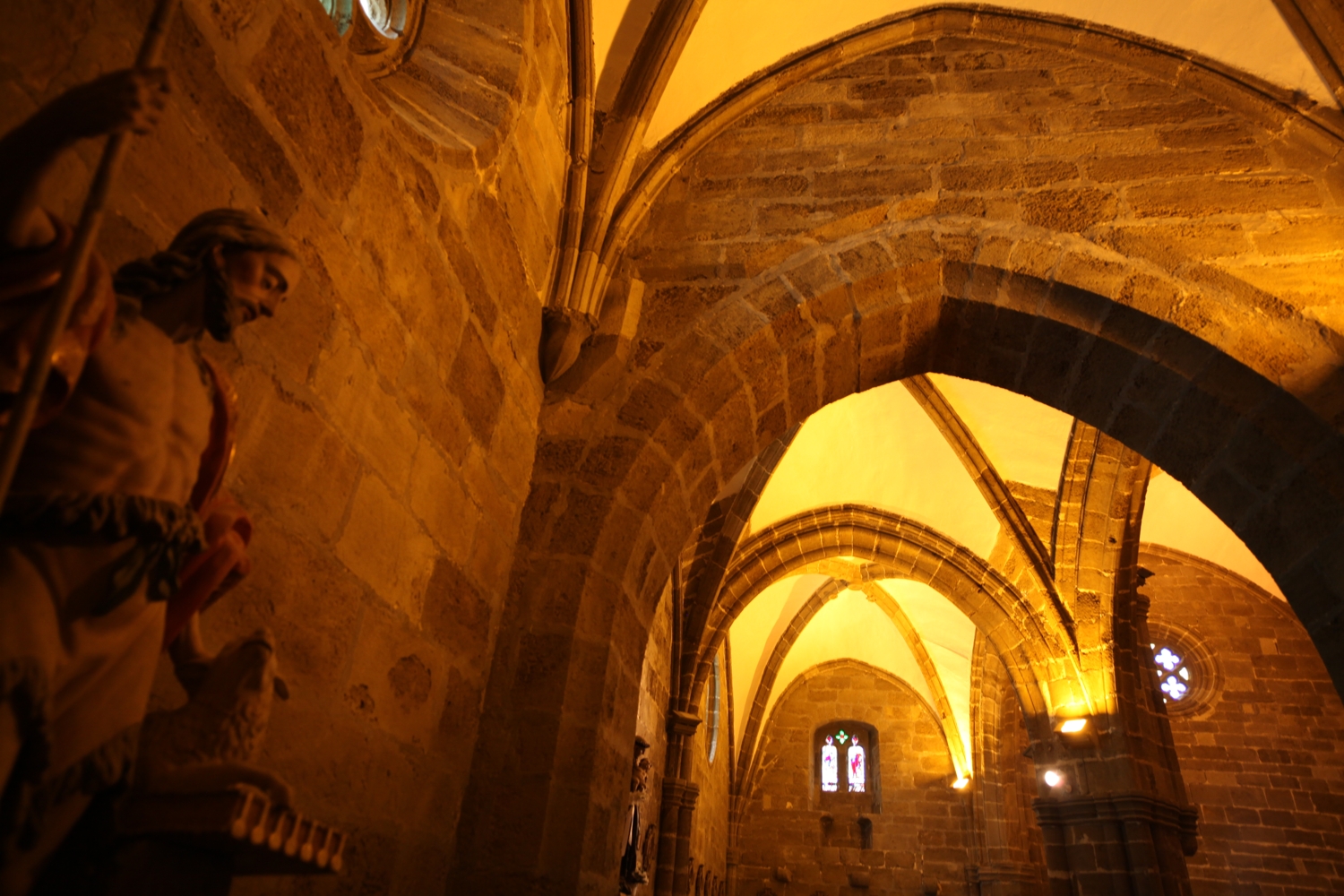
| dc.description.abstract | [ES] La iglesia de Santa María tiene una planta de unos 22x18 metros y cuenta con tres pórticos (sur, oeste y norte) así como una espadaña exenta. Adyacente al sudeste se encuentra la ermita de Santa Lucía. Las excavaciones arqueológicas de dos zonas de unos 6 x 3 metros en el interior y el exterior de la iglesia sirven como hilo conductor a las jornadas de puertas abiertas al público. | es |
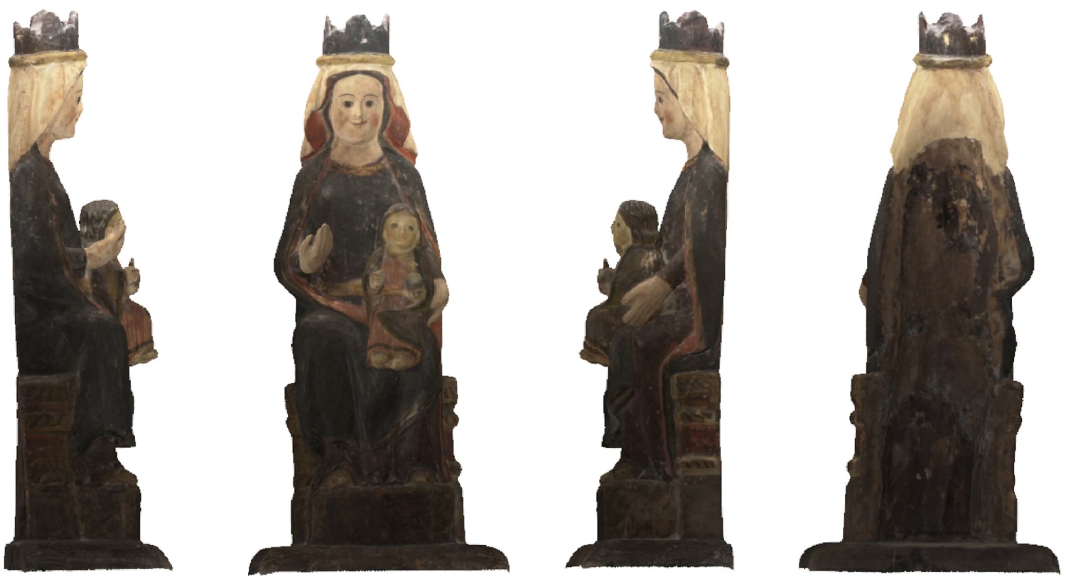
| dc.description.abstract | Para el establecimiento de la red de referencia, se han utilizado receptores GNSS enlazados a la red de referencias del Gobierno Vasco. La documentación de las excavaciones se ha realizado mediante topografía clásica para la identificación de los perímetros de las unidades estratigráficas y fotogrametría para la generación de modelos 3D con textura fotográfica de cada nivel de excavación. Por otro lado se ha realizado el modelado 3D mediante técnicas fotogramétricas de varios elementos muebles y, finalmente, se ha generado una aplicación de Realidad Aumentada tomando como objeto la talla medieval de la virgen. | es |
| dc.description.abstract | [EN] The church of Santa María has a plan of around 22 by 18 metres and counts on three porticos (north, west and south) and a free-standing bell gable. Adjacent to this building on the southeast side is Santa Lucía’s shrine. The archaeological excavations of two areas of around 6x3 metres inside and outside the church serve as an excuse for open days and other cultural activities. | en |
| dc.description.abstract | The reference network was observed by means of GNSS receivers. The documentation of the excavation was done with conventional surveying equipment (total station) for the line drawing of the unities and photogrammetry in order to obtain a 3D model with photographic texture of each level. Besides, 3D models were also produced of a series of elements (statues, baptismal font, etc.) and, finally, an application of Augmented Reality of the medieval carving of the virgin was also generated. | en |
| dc.description.sponsorship | Gobierno Vasco, Ayuntamiento de Laudio/Llodio | es |
| dc.description.tableofcontents | [ES] Memoria del proyecto (49 páginas incluyendo anexos, en español, formato PDF) + 6 fotografías de documentación + aplicación de Realidad Aumentada para dispositivos Android (fichero .apk e imagen que se utiliza como marcador). | es |
| dc.description.tableofcontents | [EN] Report with annexes (49 pages in Spanish, PDF file) + 6 photograph for documentation purposes and an application of Augmented Reality for Android devices, consisting of an .apk file and an image used as the marker. | en |
| dc.language.iso | spa | es |
| dc.relation.ispartofseries | LDGP_mem_040-1 | |
| dc.relation.uri | http://hdl.handle.net/10810/24487 | |
| dc.relation.uri | http://hdl.handle.net/10810/32114 | |
| dc.rights | info:eu-repo/semantics/openAccess | es |
| dc.rights.uri | http://creativecommons.org/licenses/by-nc/4.0/ | * |
| dc.subject | patrimonio cultural | es |
| dc.subject | edificio religioso | es |
| dc.subject | reconocimiento topográfico | es |
| dc.subject | fotogrametría | es |
| dc.subject | cultural heritage | en |
| dc.subject | religious buildings | en |
| dc.subject | surveying | en |
| dc.subject | photogrammetry | en |
| dc.title | [A_Llodio_Yermo] Documentación geométrica para la puesta en valor y difusión social del Santuario de Santa María del Yermo (Laudio/Llodio, Álava) | es |
| dc.title.alternative | Geometric documentation for valuing and extending the social use of “El Yermo” Sanctuary (Llaudio/Llodio, Álava, Spain) | en |
| dc.type | info:eu-repo/semantics/report | es |
| dc.rights.holder | Attribution-NonCommercial 4.0 International | * |
| dc.coverage.spatiallink | http://maps.google.com/maps?q=43.17187,-2.97168 | |
| dc.coverage.spatiallink | http://vocab.getty.edu/tgn/7307306 |
Files in this item
This item appears in the following Collection(s)

Except where otherwise noted, this item's license is described as Attribution-NonCommercial 4.0 International