 Back
Back[RA_Logroño-Laguardia_Mantible] Documentación geométrica del puente de Mantible, Logroño (La Rioja) y Laguardia (Álava)
| dc.contributor.author | Rodriguez-Miranda, Alvaro | |
| dc.contributor.author | Valle Melón, José Manuel  | |
| dc.coverage.spatial | Puente de Mantible (Logroño, Laguardia) | |
| dc.coverage.spatial | Logroño, La Rioja, España/Spain (Getty TGN: 7007928) | |
| dc.coverage.spatial | Laguardia, Álava, España/Spain (Getty TGN: 7007909) | |
| dc.coverage.temporal | 2017 | |
| dc.date.accessioned | 2019-08-14T07:45:57Z | |
| dc.date.available | 2019-08-14T07:45:57Z | |
| dc.date.issued | 2017-09 | |
| dc.identifier.citation | Laboratorio de Documentación Geométrica del Patrimonio (Universidad del País Vasco-Euskal Herriko Unibertsitatea UPV/EHU) –LDGP-. Documentación geométrica del puente de Mantible, Logroño (La Rioja) y Laguardia (Álava). 2017 | es_ES |
| dc.identifier.uri | http://hdl.handle.net/10810/34923 | |
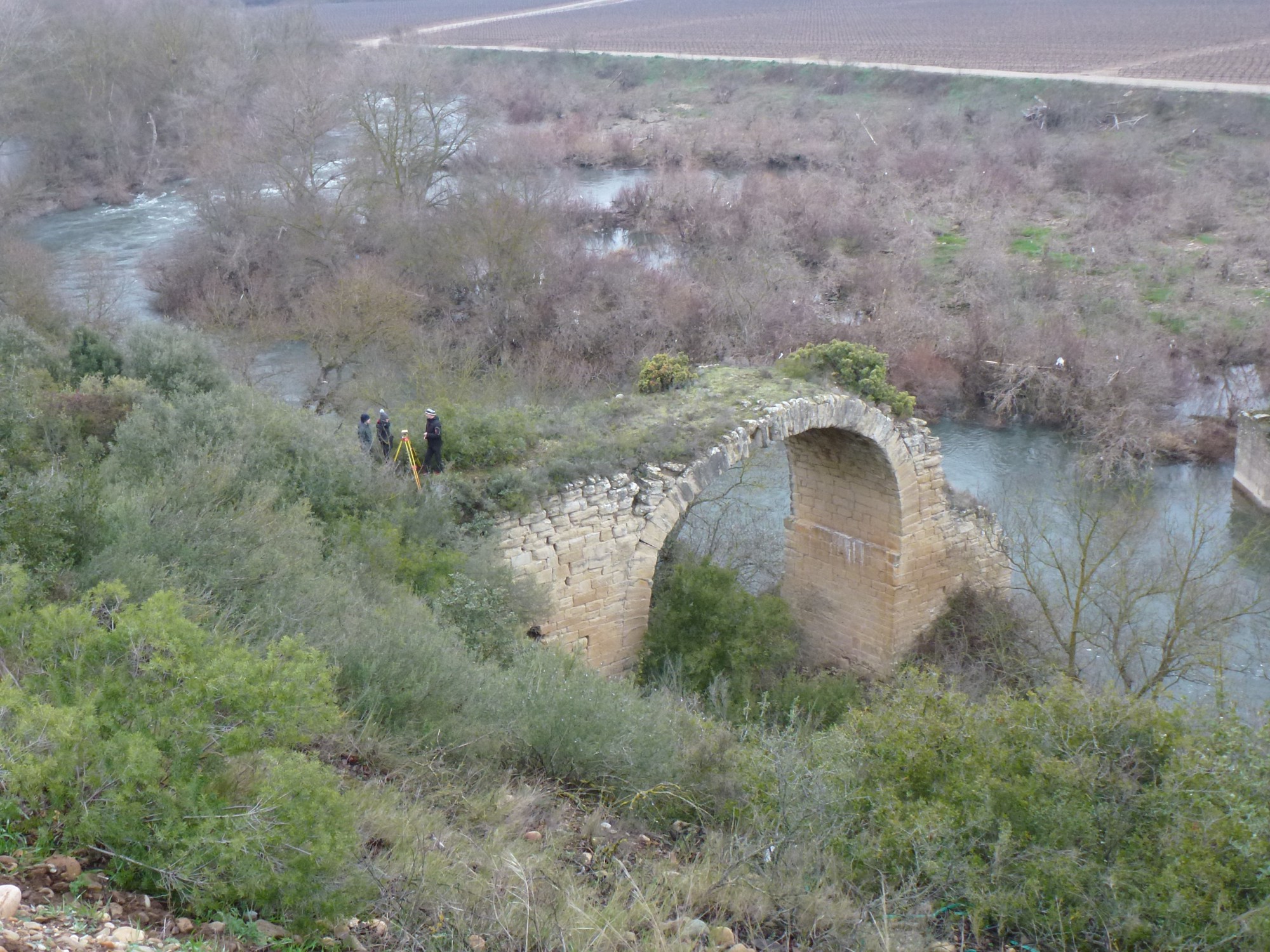
| dc.description.abstract | [ES] Se trata de un puente de posible origen romano (s.II) aunque algunos autores prefieren situar su origen en época medieval. Originalmente debió contar con un total de 7 arcos y algo más de 160 metros de longitud. Actualmente, sin embargo, sólo subsisten dos arcos: el primero y el tercero empezando por la derecha aguas arriba. El arco 1 tiene una luz de unos 10 metros y el arco 3 de unos 20 metros. El estado de conservación es malo (en especial el del arco 1) y la zona está descuidada, existiendo una importante colonización vegetal. La documentación se realizó mediante fotogrametría, tanto desde el terreno como tomas aéreas mediante un dron. El enlace con la red oficial se estableció mediante observaciones a satélite (GNSS). Las colecciones de fotografías convergentes se procesaron para genera nubes de puntos densas y modelos de mallas de los arcos, lo cuales se utilizaron como base para la obtención de ortoimágenes y el dibujo del despiece de sillares. Asimismo, se presenta un conjunto de planos de planta, secciones y alzados. | es_ES |
| dc.description.abstract | [EN] This is a bridge considered as Roman (second century BC), although some authors prefer to place their construction during the Middle Ages. In origin it should have had 7 arches and been more than 160 meters long. Currently, however, only two of the arches remain, the ones in positions 1 and 3, starting from the right upstream. Arch number 1 has a span of around 10 metres, whereas arch 3 has a span of around 20 metres. The conservation state is bad (in particular the Arch 1) the area is neglected and highly colonized by plants. The geometric documentation was done by means of photogrammetry, taking both kind of photographs from the ground and aerial ones with a drone. The link with the official reference system was done with satellite observations (GNSS). The series of photographs were processed with software for convergent photogrammetry in order to obtain point clouds and meshed models of the arches. These models were subsequently used for generating the line drawing of the ashlars and the orthoimages. Likewise, a collection of plans, elevations and cross-section was generated. | en |
| dc.description.sponsorship | Instituto de Estudios Riojanos. Gobierno de La Rioja (España) | |
| dc.description.tableofcontents | [ES] Documento PDF que contiene la memoria descriptiva de los trabajos (55 páginas) y copia de los planos en formatos A1 y A3. Se incluyen también 4 fotografías de documentación de los trabajos y 4 modelos virtuales 3D en formato PLY. | es_ES |
| dc.description.tableofcontents | [EN] PDF file with the report of the works (55 pages) and copy of the collection of plan in sizes A1 and A3. Besides, this record contains 4 pictures for documentation purposes and 4 virtual 3D models in PLY format. | en |
| dc.language.iso | spa | es_ES |
| dc.publisher | Laboratorio de Documentación Geométrica del Patrimonio (UPV/EHU) | es_ES |
| dc.relation.ispartofseries | LDGP_mem_044-1 | |
| dc.rights | info:eu-repo/semantics/openAccess | es_ES |
| dc.rights.uri | http://creativecommons.org/licenses/by/3.0/es/ | * |
| dc.subject | patrimonio cultural | es_ES |
| dc.subject | puente | es_ES |
| dc.subject | reconocimiento topográfico | es_ES |
| dc.subject | fotogrametría | es_ES |
| dc.subject | cultural heritage | en |
| dc.subject | bridges | en |
| dc.subject | surveying | en |
| dc.subject | photogrammetry | en |
| dc.title | [RA_Logroño-Laguardia_Mantible] Documentación geométrica del puente de Mantible, Logroño (La Rioja) y Laguardia (Álava) | es_ES |
| dc.title.alternative | Geometric documentation of the of the Mantible bridge, Logroño (La Rioja) and Laguardia (Álava) - Spain | en |
| dc.type | info:eu-repo/semantics/report | es_ES |
| dc.rights.holder | cc-by | es_ES |
| dc.rights.holder | Atribución 3.0 España | * |
| dc.coverage.spatiallink | http://maps.google.com/maps?q=42.5100,-2.5080 | |
| dc.coverage.spatiallink | http://vocab.getty.edu/tgn/7007928 | |
| dc.coverage.spatiallink | http://vocab.getty.edu/tgn/7007909 | |
| dc.contributor.funder | Instituto de Estudios Riojanos (Gobierno de La Rioja) |
Files in this item


This item appears in the following Collection(s)

Except where otherwise noted, this item's license is described as cc-by