 Back
BackSearch
Now showing items 1-10 of 14
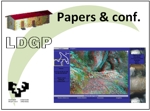
Aportaciones metodológicas a la gestión y explotación de nubes de puntos procedentes de escáneres tridimensionales, aplicados a la documentación geométrica del patrimonio. El caso de la Portada de los Hierros de la Catedral de Valencia
; Valle Melón, José Manuel  ; Casar Pinazo, José Ignacio; Esteban Chapapría, Julián (Centro Internacional para la Conservación del Patrimonio (CICOP), 2008-07)
; Casar Pinazo, José Ignacio; Esteban Chapapría, Julián (Centro Internacional para la Conservación del Patrimonio (CICOP), 2008-07)
[ES] La medida y representación de elementos patrimoniales, a través de su documentación geométrica, es una de las necesidades previas a la realización de cualquier tipo de intervención para su conservación o restauración, ...

Importancia del proyecto en la documentación geométrica del patrimonio
Valle Melón, José Manuel ; ; Sanz Adán, Félix (2008-02)
; ; Sanz Adán, Félix (2008-02)
[ES] La medida y representación del un elemento patrimonial debe responder a unas necesidades. Será difícil plantear un proceso de documentación geométrica encaminado exclusivamente a conservar la información sobre su forma ...
Evaluation of the conventional surveying equipment applied to deformation analysis of heritage buildings. A case study: the bell tower of Santa María la Blanca church in Agoncillo (La Rioja, Spain)
Valle Melón, José Manuel ; ; Pérez Vidiella, Pablo (International Federation of Surveyors (FIG), 2008-05)
; ; Pérez Vidiella, Pablo (International Federation of Surveyors (FIG), 2008-05)
[EN] A typical feature of heritage buildings is their fragility that is displayed by means of several pathologies such as wall sloping or cracks. Although there are some model projects on monitoring, they are usually ...

3D line drawing from point clouds using chromatic stereo and shading
; Valle Melón, José Manuel ; Martínez Montiel, José María (Virtual Systems and Multimedia – VSMM2008, 2008-10)
; Martínez Montiel, José María (Virtual Systems and Multimedia – VSMM2008, 2008-10)
[EN] Terrestrial laser scanners (TLS) have become a common tool in geometric documentation of heritage. As output, they can produce point clouds along with thematic information such as reflectance or photographic texture. ...
Radiometric balance of photographic textures in virtual models and point clouds of heritage elements
; Valle Melón, José Manuel ; Lopetegi Galarraga, Ane (Laboratorio de Documentación Geométrica del Patrimonio (LDGP), 2007-09)
; Lopetegi Galarraga, Ane (Laboratorio de Documentación Geométrica del Patrimonio (LDGP), 2007-09)
[EN] When facing the representation of heritage elements, a wide range of graphical products are at our disposal which incorporate photographic texture, such
as ortophotographs, virtual models or point clouds. Photographic ...
Time transcendence, metadata and future utilization in 3D models of point clouds for heritage elements
; Valle Melón, José Manuel ; Lopetegi Galarraga, Ane (Ausonius éditions, 2007-11)
; Lopetegi Galarraga, Ane (Ausonius éditions, 2007-11)
[EN] Heritage is not static, on the contrary, it is subject to continuous modifications and transformations which, at worst, go as far as to their complete disappearance; for this reason, information referring to heritage ...
Modelo de representación y difusión de cavidades. Cueva de Praileaitz. Deba, Gipuzkoa
Lopetegi Galarraga, Ane ; Valle Melón, José Manuel ; (2004-10)
; Valle Melón, José Manuel ; (2004-10)
[ES] La documentación de una cueva conlleva toda una serie de problemas metodológicos (oscuridad, condiciones extremas de temperatura y humedad, difícil accesibilidad, complejidad de elementos a representar...). Hasta hace ...
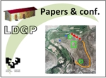
Documentación geométrica de un yacimiento arqueológico de gran extensión. El ejemplo de Contrebia Leukade (La Rioja)
Valle Melón, José Manuel ; ; Lopetegi Galarraga, Ane (2004-10)
; ; Lopetegi Galarraga, Ane (2004-10)
[ES] La investigación histórica en yacimientos arqueológicos de grandes dimensiones, requiere de un soporte gráfico con base geométrica en el que puedan ser referenciados los hallazgos, reflejadas las épocas históricas, ...
Enfoque cartográfico de los modelos virtuales de elementos patrimoniales
; Valle Melón, José Manuel ; Lopetegi Galarraga, Ane (2004-10)
; Lopetegi Galarraga, Ane (2004-10)
[ES] Los modelos virtuales de edificios históricos u otros elementos patrimoniales cuentan con una gran variedad de aplicaciones relacionadas, sobre todo, con la difusión y multimedia. Aunque en muchas ocasiones se trata ...
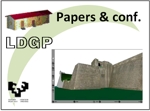
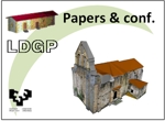
Problems when generating virtual models representing real objects: Hondarribia walls
Valle Melón, José Manuel ; Lopetegi Galarraga, Ane ; (2006)
; Lopetegi Galarraga, Ane ; (2006)
[EN] This report shows an example of virtual modelling applied to a heritage construction, the walls of the city of Hondarribia (Gipuzkoa, Spain). Therefore, it is not a model recreating a building upon hypothetical data ...